Try Our New Feature
Shallow Water Monitoring Calibration Station
Map and Data Download Tool

Status and Trends Data and Maps Updated Through 2022
https://eyesonthebay.dnr.maryland.gov/eyesonthebay/statustrends.cfm

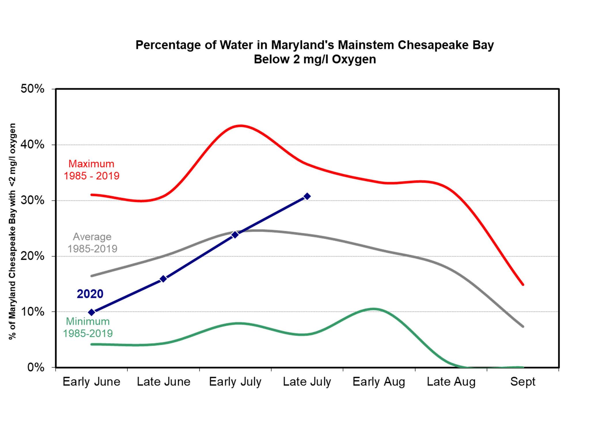
All 2020 Chesapeake Bay water quality data deliverables have been submitted to the Chesapeake Bay Program (CBP). Select station data can be downloaded via station tables on our website, under the DATA tab.
Custom queries can be made via the CBP datahub:
http://data.chesapeakebay.net/WaterQuality.
As always, our data status can be tracked at:
http://eyesonthebay.dnr.maryland.gov/eyesonthebay/DataStatus.cfm
Where's the Data?
2020 was obviously a challenging year. Our biologists, who have been out in field with the exception of March-April 2020, have followed strict guidelines while sampling during the pandemic. Our formal data submissions to the Chesapeake Bay Program have been delayed, in most part because our data entry provider was shutdown until late December 2020. Now that we're slowly receiving those laboratory and field data back, they will undergo a rigorous Quality Assurance process, prior to final submission and availability.
For data status updates by month and monitoring program, please visit our status page at:
http://eyesonthebay.dnr.maryland.gov/eyesonthebay/DataStatus.cfm

Our Mallows Bay buoy was recently removed for the winter.
We will redeploy in the Spring of 2021.
Thanks to the National Marine Sanctuary Foundation
for funding the purchase of the buoy.
https://marinesanctuary.org/sanctuary/mallows-bay-potomac-river/